GPX data becomes real GPS art when you use an app like JOSM to set it free from the map and bring it to life with custom colour choices
Since I started using my Garmin, my bike and a map of Victoria to make GPS doodles, I’ve generally referred to myself as a ‘Strava artist’. But ever since February, when an online observer pointed out that “it’s ‘GPS-tracking art’, not ‘Strava art'” (something I blogged about here), I’ve had the urge to explore possibilities beyond Strava.
Last week I got the nudge I needed when a fellow GPS doodler (of “HIRE ME” fame) shot me a Tweet about SISU – an app that renders “Your Exercise Data As Art.” Linking to your Strava or Runkeeper account, it gathers up your rides or runs within a specified period and creates a collage that looks like this.
Cool, but limited in the fact that it incorporates all activities with the same tag (like “Ride” or “Run”). So if I wanted a compilation of just my GPS doodles, I’d have to tag them as a different activity (like Surfing or Yoga, since Strava doesn’t currently support custom tagging).
So I did a little poking around, and my travels through Google eventually brought me to JOSM – an extensible editor for OpenStreetMap.
What I love about JOSM is the ability to assign any colour code or colour value (RGB, CMYK, HSV or HSL) to backgrounds, GPS points and a long list of other settings.
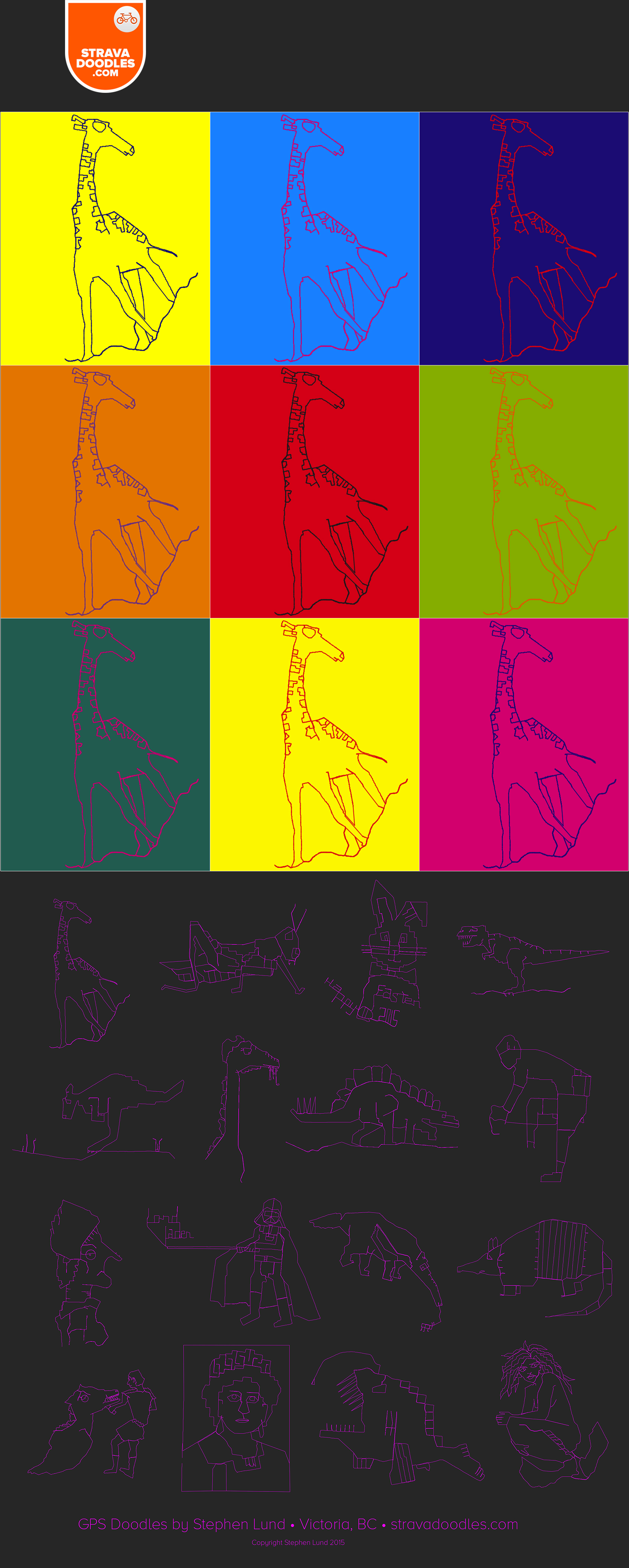
Using JOSM and the GPX data for the GPS giraffe I doodled back in February, I produced the colour variations for this Andy Warhol inspired collage. And loading the GPX files for a variety of my doodles made it easy to create a map-less compilation of my favourites.


That’s awesome. You should have that printed on a canvas for your wall. 🙂
LikeLiked by 1 person
That’s a great idea! In the works…
LikeLike