A European country recreated in a North American city. GPS doodling makes anything possible!
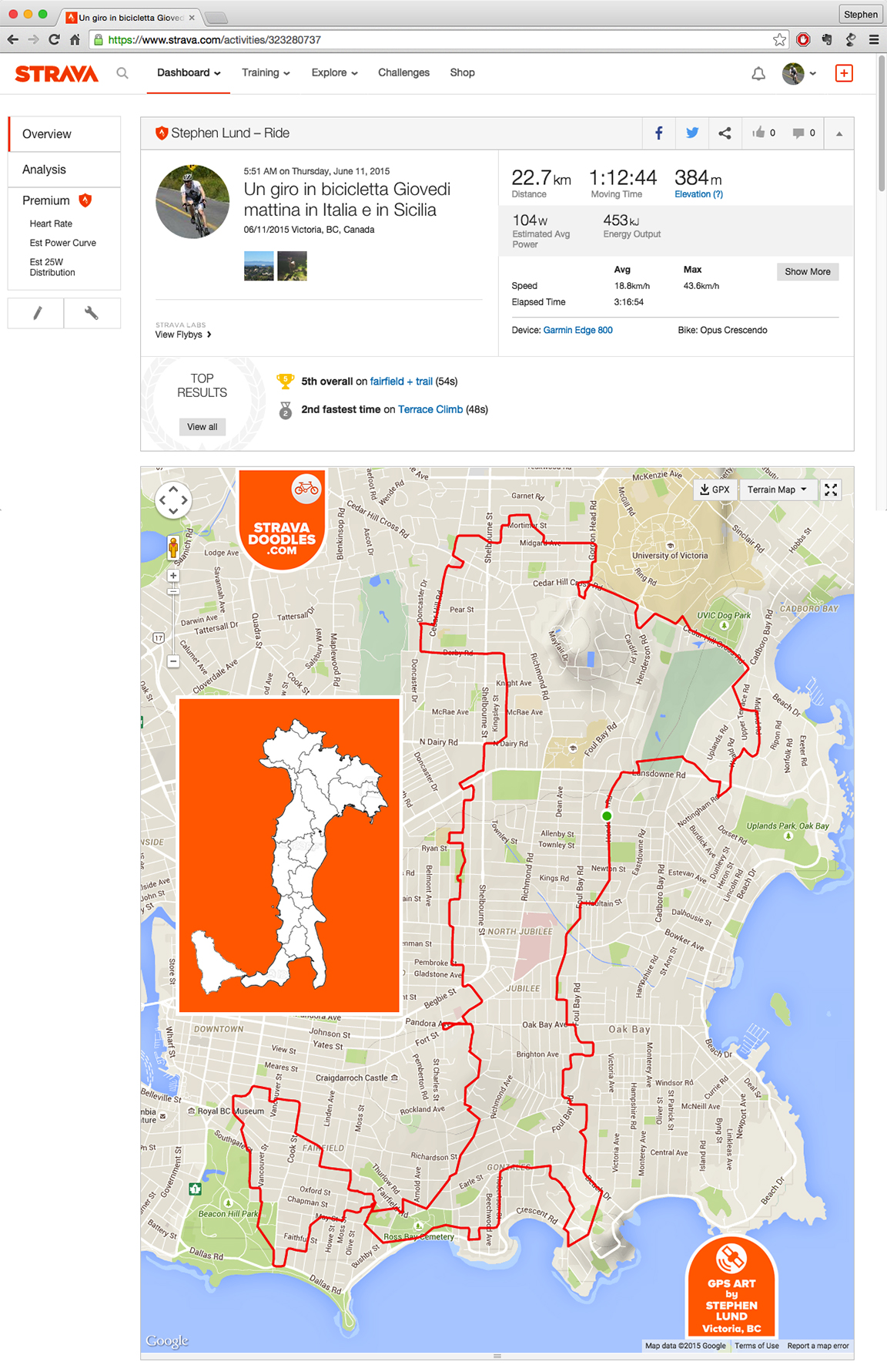
A GPS-art illustration of Italy and its largest island, Sicily, by Stephen Lund on the streets of Victoria, BC. The inset illustration shows the actual shapes of Italy and Sicily.
On Wednesday mornings, I often join the Fairfield Farm Team for a ride whose route (as several Strava followers have pointed out) looks like Italy.
Yes…a little.
This got me thinking. “If a route through Victoria inadvertently looks a little like Italy, surely there must be a route through Victoria that purposefully looks a lot like Italy.”
I think I found it.
See it on Strava
Note: The GPS points will render correctly only if you are logged in at Strava.com
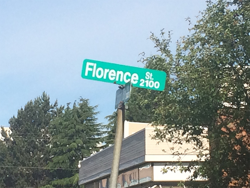
I was very near the end of my ride when I happened upon Florence Street – a perfect fit with my Strava-doodle of Italy.

