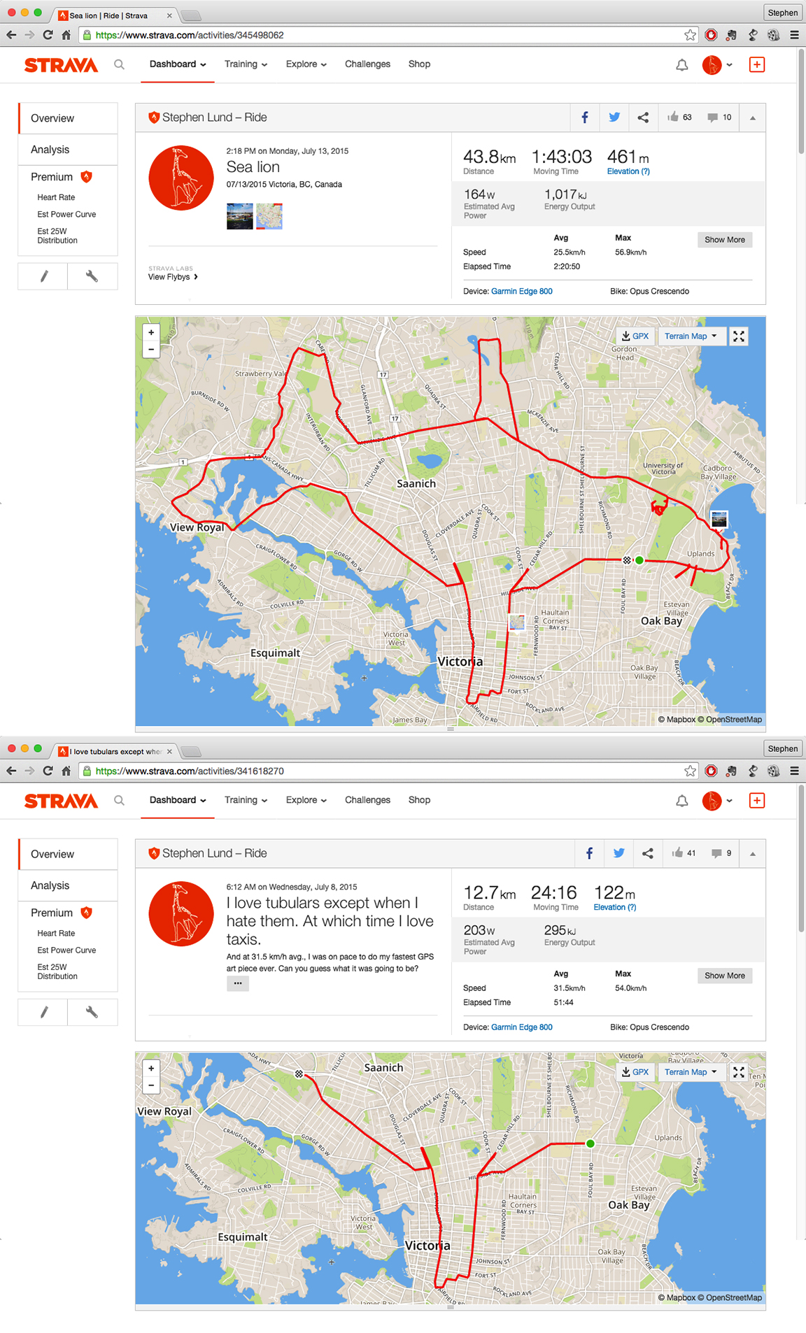
My efforts in creating this 44-km (27-mi) GPS sea lion were interrupted with a couple of valuable reminders: watch out for debris on the edge of the highway, and always ride with a pocketful of cab fare
I sketched this big fella several weeks ago, on a sunshiny afternoon in mid-July.
It’s the type of GPS doodle I like best, where 100% of the picture follows the streets of the city and my ride follows one continuous line from start to finish. (That said, I did have to stop/start my Garmin twice and make a few kilometres worth of detours along the way – once to safely cross the highway to Wilkinson Road at the bottom of the tail, and again at the tip of the left flipper to get around a big fence between GardenWorks and the Galloping Goose.)
These detours underscore two important tenets of my GPS doodling:
- Safety supersedes everything else
- Cycling citizenship must be top-of mind; represent cyclists and cycling in positive ways (for example, by always respecting private property).
My sea lion ride on July 13 was my second attempt at this huge marine mammal. My first, five days earlier (lower image), ended when my front tubular sustained an irreparable gash on the side of the highway 13 km (8 mi) into the doodle. (That stroke of bad luck was offset by the fact that an available cab appeared precisely as I was pondering my next move.)
See it on Strava *
* Note: The GPS points will render correctly only if you are logged in at Strava.com


I like the detail of the whiskers! Very cool
LikeLiked by 1 person
How many kms. was required to achieve this mammalian vision of laziness?
LikeLiked by 1 person
44 km. Plus another 13 if you count the km from attempt #1.
LikeLike